11 Jul 2025
An amateur archaeologist believes he has stumbled across a major discovery which suggests the St Albans district could have been a culturally significant centre of prehistoric British life.
Writer Tony Rodway, 54, has been working on the project for the past four years, exploring a section of Sandridge village which he believes holds the key to unlocking a wider mystery caught up in the stories of King Arthur, the Holy Grail and Bran the Blessed – also known as the Fisher King.
He said: “There is nowhere in this neck of the woods that is not part of a landscape rich in nationally important archaeology. The major work that I am currently undertaking, which relates very closely to this apparently insignificant field (and many like it in the region), has revealed this area to be as important to the prehistory of Britain as the landscape surrounding the Hill of Tara is to Ireland – it is nothing less than the centre around which thousands of years of prehistory revolved.
“Unless a thorough investigation is made of the remains hidden under this small piece of earth, no building work should ever be undertaken; and even then, only with the greatest sensitivity and respect. This is part of a bigger picture that no sane person would ever even wish to obscure, let alone close their eyes to.”
The legend of New Troy, a city founded by a group of exiled Trojans long before the Roman conquest of Britain, was identified as London by the 12th century writer Geoffrey of Monmouth and named Trinovantum, in reference to the Iron Age tribe of the Trinovantes.
But was it in fact located closer to home, spreading across much of modern St Albans, misidentified because London was the beginning of Watling Street, the road that led to the real New Troy?
Tony explained how there is much more to the history of St Albans than Romans and Christians, which form the crux of contemporary accounts of the city’s past: “It is less widely known that prior to the Roman occupation and the foundation of Verulamium, for almost a hundred years on the self-same piece of land, there existed the Celtic city of Verlamio. It was from here that King Tasciovanus ruled. And it was Adminius, the grandson of Tasciovanus, who founded Verulamium.
“Archaeological excavations have shown that Adminius was buried with great honour on an already sacred hillside overlooking Verulamium; his death having occurred seven or eight years after the start of the occupation, about the same time that his brother Caratacus was being taken in chains to Rome for leading the British resistance.
“It’s also not generally known that Verlamio began its life approximately 20 years after the short befouling visit made to this area by Julius Caesar in 54bce.
“The archaeologist Sir Mortimer Wheeler hypothesised in the 1940s that the location of the decisive battle that took place between Julius Caesar and Cassivellaunus (king of the Britons) was likely just to the east of Wheathampstead.
“Cassivellaunus’s stronghold, in his view, was located between two ancient earthworks on a ridge overlooking the river Lea; which Wheeler referred to as ‘The Wheathampstead Oppidum.. The western feature is known as Devil’s Dyke. The eastern feature is called The Slad. Both features comprise deep gulleys cutting through the earth topped with high banks.
“The generally accepted theory is that the people associated with Devil’s Dyke abandoned the area sometime in the two decades following Caesar’s defeat of Cassivellaunus, and were the same people who set up Verlamio; which Wheeler had excavated in detail, along with Verulamium.
“Taking Sir Mortimer at his word – and the plaque on the gate beside the entrance to Devil’s Dyke – it appears probable that the people of Verlamio were refugees, survivors, and the descendants of survivors of a likely massacre committed by the tyrant Julius Caesar; witnesses to an ancient war-crime; an atrocity on a scale never before seen in the islands of Britain – in consequence of which these people deserted the land of their birth and moved west, stopping within lamentable sight of their former home, just across the river Ver; daily confronted by an open wound.
“It appears that when Julius Caesar departed this place, having gained very little other than a few hostages and a politicised tale to tell, he left behind him a textbook wasteland, where once had been an ancient centre of high ‘Celtic’ civilization, all that remained was desolation.”
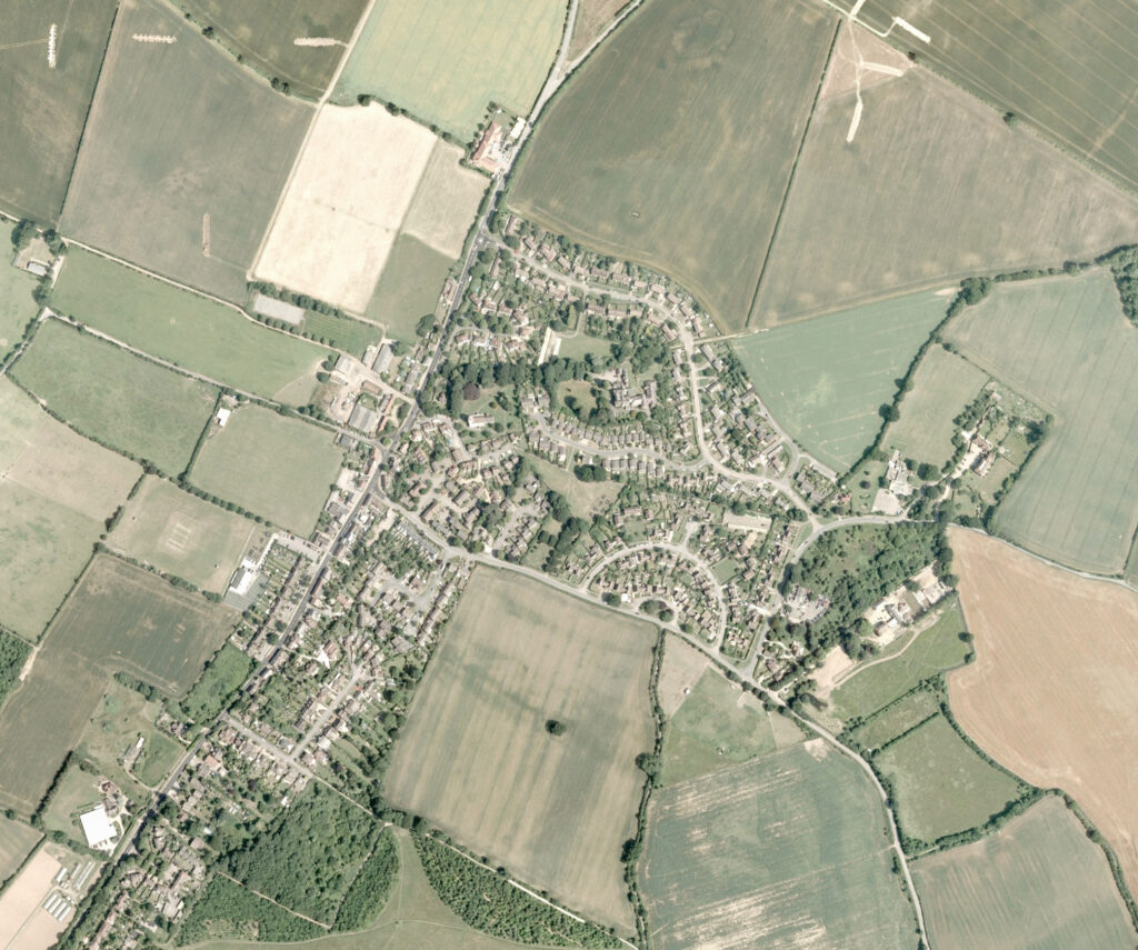
Ten years ago, while trying to solve the mystery surrounding the location of Caesar’s camp using aerial and satellite images, Tony happened upon an anomalous parchmark in a small triangular field in the centre of Sandridge village.
Not only did this cut across a footpath which maintains the line of a former ancient trackway from Woodcock Hill to Langley Wood, but the Norman church of St Leonard’s was partly built of Roman tile thought to have come from a temple built on the site of an earlier Iron Age temple. Unfortunately, the ditch disappeared into the cemetery, making it impossible for him to trace further using satellite photos.
For eight years, Tony awaited any news regarding the availability of open-source LiDAR, a then little-known process which stands for Light Detection and Ranging, and uses light in the form of a pulsed laser to create highly accurate 3D models of landscapes and objects.
He then had what one might describe as an epiphany: “No one was more surprised than I, when, having lived 50 disordered years, with no prospects and even fewer expectations, suddenly the mist lifted, and out of the clear blue summer sky, I caught a glimpse of something fundamental, yet unknown to British history.
“Julius Caesar’s coming here was not by chance, it always lived within the mythic script – an inevitability, scored deep into the earth, long before the balding little tyrant had even heard the name Britain.
“Over eons this place gained its fame. Where else would such a man come? This was Britain’s battleground, blessed by Bran himself; the brightest centre of pre-Christian life in all the mighty islands of Britain – challenged only by the Hill of Tara.
“For at least a thousand years before the Roman occupation – and again, for a brief time afterwards, prior to the fall of Arthur – this sacred place was seen as an unquenchable beacon. Snuffed out in a heartbeat.
“The people who travelled here from all parts of Britain would exchange stories with one another; individually, and during meetings between delegations of kings and their retinues. And of all the tales first told in the flicker of firelight, it was the ones that were composed and transmitted from Trinovantum – where the narratives were written in the land itself – that were remembered most; stories that we still know today as myths; the oldest stories, copied down by monks frozen in scriptorium gloom; words forever pawed over for a clue to their impossible riddles.”

What Tony is convinced he has uncovered is the lost capital of prehistoric Britain, home of the legendary Fisher King, here in the St Albans district, with Sandridge at its heart.
He believes ancient low-banked ditches, constructed over a period of approximately 1,500 years, created a vast geoglyph – a complex narrative image inscribed in the earth itself – which depict different images from The Four Branches of the Mabinogi, an obscure collection of medieval writings compiled from a much earlier orally transmitted set of tales about British mythology.
He argues that the weight of archaeological evidence, including Bronze Age remains, mines, pits and temples, combine to present the area as one of vital importance.
“This was a search for the forgotten lines and location of the former capital of Britain, lost with the coming of the Romans; where kings were made and centuries of wonders beheld; a fabled place, analogous to, and culturally connected with, the landscape surrounding The Hill of Tara in Ireland.”
But Tony’s modern day Grail quest has been frustrated by a lack of interest from academics, who have disregarded his findings or failed to respond to his enquiries, and he has hit a brick wall…
“Unless, that is, I can get the right people to acknowledge the potential reality of what I believe to be a completely genuine discovery.
“If I was presented with it, I would probably feel the same way, but I would at least consider it based on the evidence, rather than just dismiss it.
“But, if I can get an actual archaeologist interested, hopefully I can then work with them to find the most appropriate way to verify my claims – I think a number of small targeted excavations of the lines might be useful; and geophysical surveys of the places that seem most likely to be important settlement areas to help support the idea of New Troy being here.”