21 Apr 2025
It’s arguably fair to say that global politics have not been as precarious since the end of the Cold War and the fall of the Soviet Union, when the threat of mutually-assured destruction hung over our heads like the sword of Damocles.
But although the risk of direct conflict between the East and the West was limited by the recognition that any such conflict would likely involve the devastating use of nuclear weapons, that isn’t to say that it wasn’t considered a possibility.
Flashback to the early eighties, when US President Ronald Reagan and UK Prime Minister Margaret Thatcher indulged in frequent sabre-rattling with the USSR’s Yuri Andropov, and TV shows like Threads [1984] offered a very dramatic account of the potential medical, economic, social, and environmental consequences of a nuclear war in Britain, and you can understand why many people considered it wasn’t a question IF there was a Third World War, but WHEN.
Take the month of March 1983 in particular: both the USSR and USA were still carrying out nuclear tests, Reagan described the Soviet Union as “the evil empire” in a speech in Florida, and the USA’s Strategic Defense Initiative (“Star Wars”) was announced.
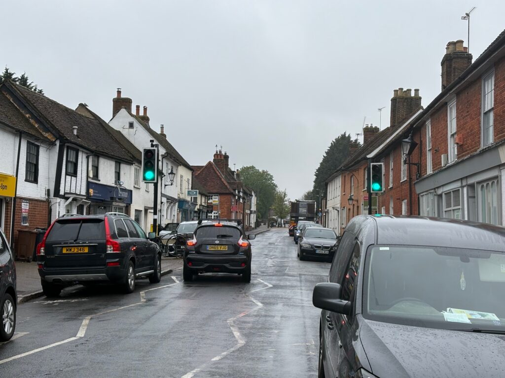
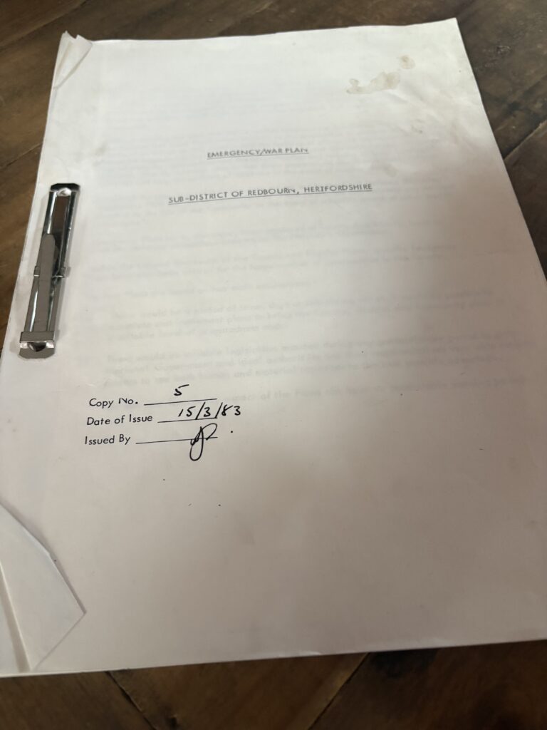
Meanwhile, in a small village in Hertfordshire, just north of St Albans, an emergency/war plan was provided to the sub-district of Redbourn as part of nationwide preparations to “save lives, relieve suffering and help the millions of survivors in the event of a nuclear war”.
Although the estimated number of those people left alive after such a conflict might be optimistic, there’s no denying the seriousness given to the situation, with the creation of “plans to provide and maintain any services essential to the life of the community in the event of a hostile attack or any other drastic catastrophe” such as nuclear accidents.
The plan for Redbourn is likely to be very similar to others distributed across the county, but a copy of this particular 66-page document is now in the archives of the St Albans Times, which is why we have focused on that specific village.
Much of what it covers is somewhat self-explanatory: plans for refugees from the London area, control and distribution of limited food supplies, rescue operations by the emergency services, and of course, the burial of the dead – possibly in mass graves.
Drilling down to a local level, and community advisers and sub-district staff are tasked with dealing with problems in relation to the maintenance of law and order, public utility services and morale, as well as shortages of many commodities.
So how was this expected to work?
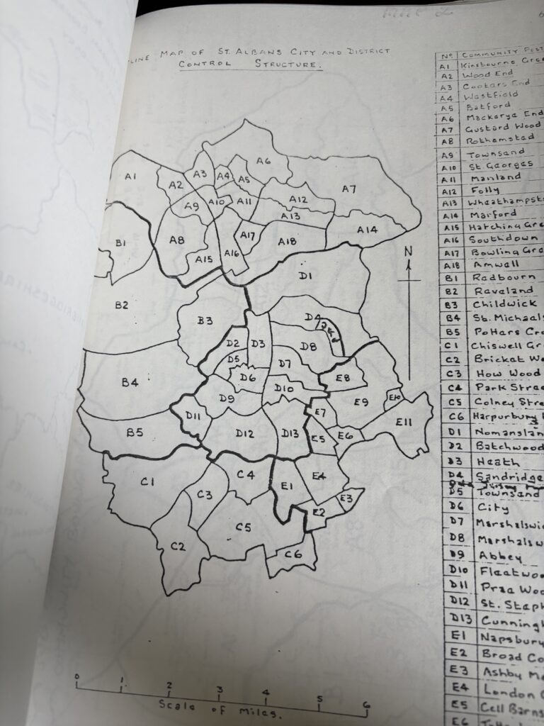
According to the plans, St Albans City and District was to be considered a local network with five sub-districts: Harpenden, Redbourn, Bricket Wood, St Albans City and London Colney, each further divided into smaller areas.
Fascinatingly, the overall control of the operation is said to be in the hands of SADC chief executive Mr (Reg) Braddon, based out of the magistrates court rooms in St Albans.
Reg Braddon enjoyed a career with GEC Cables and Equipment Limited before coming to St Albans in March 1976, remaining in the role until March 1989, during which time he was responsible for developing land off Chequer Street as the Maltings Shopping Centre. He died in 2015.
The document goes on to name other members of staff working in the sub-district, including controller John Spreull, his personal assistant Don Kiddle, emergency feeding officer Sonya Bailey, sanitation coordination Tessa Abbott and health officer Dr John Cuthbert.
All of these people lived in Redbourn, with their full addresses and phone numbers included in the plans for reference, as is the site of the sub-district HQ, in the Brooke Bond tea-packing factory which once occupied The Mill and eventually closed in 1994.
The plans noted: “The nearby Common could provide a helicopter or light aircraft strip for communications, casevac [the rapid and often unscheduled evacuation of casualties to medical facilities elsewhere] and air-freighting supplies, or parachute dropped supplies.”

Community posts were to be established at the village hall, Shafford Farmhouse, Gorhambury and Wimbushes in Potters Crouch.
After any incident or attack, the priority would be to communicate the emergency to local residents, with means suggested including loud hailer, torches, heliograph using Morse code, CB radios and even despatch runners carrying cleft sticks, as well as more conventional means should they still be available.
Other control centres across the district were detailed as the Town Hall in St Peter’s Street (now the Museum + Gallery), Harpenden’s council offices in Southdown Road (now the Harpenden Trust), St Stephen JM School in Bricket Wood, and London Colney Secondary School in Alexander Road (which closed in 1984).
The various headquarters were required to stock up with certain equipment, including battery operated loud hailer, transistor radio and torches, and radiac instruments to monitor radiation levels. Other equipment included tie-on casualty labels, indoor games, mess items, sandbags, stationary, stretchers, spades and shovels, although the list was more comprehensive than just these items.
In order to mitigate the dangers of heat, blast and fallout, any inflammable material was to be disposed of, curtains were to be dipped in flame resistant solution, windows and doors were to be covered, and chimneys blocked up.
The quantities of rations for one, seven, 14 and 21 days in pounds were included for between 1 and 90 people, and divided into meat/fish, evaporated milks, margarine/butter, bread/biscuits sugar, jam, tea, cocoa, salt, pepper, mustard, dehydrated potato and pure orange juice.
Because of concerns about a lack of communication with county and national authorities, each sub-district was given specific duties to maintain for the interim, with the note “in order to do this, local knowledge and knowledge of local conditions and resources is essential”.
These included responsibility for welfare services, including billeting and emergency feeding centres, and identifying the resources available for dealing with damaged buildings, roads clearance, waste disposal and “other matters of importance to survival and the restoration of ordered living”.
Other tasks included assisting in the establishment of first aid posts and casualty collection points, determining what general supplies were available and allocating and distributing these accordingly, and manning of radio receiver – call sign ‘St Albans Sub-District B – on listening watch for national news broadcasts.
“The major problems are likely to result from disease and water pollution – ie eating/drinking from contaminated sources – hunger, exposure and shock, bad sanitation,” the plan warned.
In order to deal with these issues, staff needed to research and document all locally available resources, including doctors and nurses, disposal sites, slaughter houses, heavy plant machinery and food – “including hunters, game keepers and poachers”.
“There would be a period following a major attack estimated between two weeks and three months when communities would have to survive with no significant or effective support from District Control.”
This meant maintenance of law and order could be a matter of major importance, the plan noted, adding: “There have been recent examples of lawlessness in Western cities when public services (for example lighting) have been cut off for only a matter of hours.”
Was this referring to the New York Blackout of 1977, which saw citywide looting and arson for its 25-hours duration?
Staff were warned about the potential dangers: “Local selfish survivors coupled with bands of desperate refugees could present an enormous threat to communities unless the communities are organised and strong.”
It’s hard not to draw comparisons here with many of the post-apocalyptic dramas seen on films and television over the past decades, which suggests a degree of prescience in the Redbourn plan.
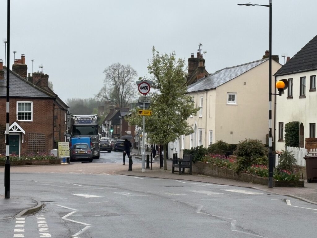
The distribution of the public information booklet ‘Protect and Survive’ had taken place between 1974-1980 to advise citizens on how best to protect themselves in the event of a nuclear attack, and the plan called on staff to visit residents to ensure they had received and understood this booklet, especially as they could find themselves confined at home for at least 14 days.
A large section of the emergency/war plan document was taken up with compiling lists, including sources of plastic sacks and sandbags, a register of the elderly or infirm, buildings which could be used as communal shelters, billeting accommodation, emergency food stocks, underground water supplies, local fuel stocks, emergency latrine sites, residents with first aid training or other medical skills, emergency latrine sites, builders merchants, hardware shops, and private stocks of petrol and diesel.
Other sections included a list of welfare shelters, which included St Mary’s Congregational House, Redbourn Infants School, The Methodist Hall and pubs The Bull, The George, The Cricketers, The Punch Bowl and The Chequers Inn, some of which are no longer open today.
A selection of these locations would also be used as emergency feeding centres.

Both Herts County Showground and Redbourn Golf Course were mooted as possible sites for largescale transit camps to house refugees.
Detailed instructions about food supplies, including storage and distribution, included livestock.
“Following a nuclear attack, if cattle have been affected by radiation but are not dead, they may be slaughtered at existing or new locally established premises. The meat will be edible but NOT the offal or bones.”
With regards to water supplies, the River Ver was to be considered as a potential source, albeit only after boiling or other treatment.
The plan then moved on to what actions were to be taken after any attack, including supporting normal peace-time emergency services in the event of an invasion using conventional weapons.
In the aftermath of any nuclear attack, local rescue teams and those who live in the damaged area were to be organised to mount a concerted effort to collect all obvious casualties, get them under cover and give them whatever first aid help was available. They were to continue until fall-out arrival was detected, in which case they were then to take cover until radiation had decayed to a level that permitted movement, a period of between three to five weeks.
It was stressed that there would be no district rubbish and waste disposal services for some weeks or months, so sites must be selected where rubbish could be buried, burned or dumped, away from water sources and dwellings.
As you might expect, the grim task of burial of the dead received a section of its own. Wherever possible bodies will be identified and the normal procedures carried out, but there would also be sites identified for mass burial, with individuals selected for a ‘dead collecting team’.
Locally, the burial site was Westfield Road Cemetery in Harpenden, with an emergency mortuary at Park Hall (now the town council offices) in Leyton Road. In the case of an extreme emergency, mass burial sites were identified at Redbournbury Toxic Waste Site off Redbournbury Lane, and derelict land north of Bylands House on Dunstable Road.
Environmental considerations also had to be taken into account, including preventing any ‘organic pollutants’ gaining access to water supplies.
“The achievement of an environmentally acceptable disposal system depends on speed, as corpses will become offensive in two to three days in hot weather, and within a week or ten days advanced putrefaction will set in.”
On a less grim note, details were also included relating to debris clearance and the repair of roads, with a map showing essential service routes across the county identified so that priority could be given to the clearance of these routes. Of these, the M1 was considered to be of national importance, with other routes designated to be of community importance instead.
There was no rousing conclusion to the document, perhaps urging the community to come together in these dark days with a view of a brighter future.
Instead, the final part of the document merely explained the procedures for mobilisation to ensure all members of the control teams would be in a state of immediate operational readiness in the event of an attack, although did note that their families would be allowed to join them where possible.
Any buildings listed in the Sub-District Plan which were not owned by HCC or SADC would be requisitioned, as would private fuel stocks, by offices responsible for specific war-time functions at the district council.
The last section of the plan was a list of contacts for local organisations, which reads like a who’s who of Redbourn community life in the early 1980s, and included the names and addresses of people from a variety of bodies, including churches, charities, playgroups, Scouts and Guides, sports clubs, political groups, and even the Common Round parish magazine.
As it transpired, the ‘eighties passed without the predicted conflict between East and West, with the advent of Perestroika at the end of the decade leading to glastnost and the fall of the Soviet Union.
Warfare between the end of the 1980s and today has been fought with conventional weapons, with the threat of nuclear attack reserved for the history books. But as tensions across the globe have escalated in recent years, the idea that nuclear weapons might be used by either side has once again become viable.
Is there a new version of the Sub-District Plan sitting on the desks of council officials across the county? Are they even now drawing up lists of resources and emergency measures in the event of any attack? What do you think?